After doing the eastern side of the ridge, I figured I'd return to the beautiful Berowra Waters for an overnight day-length walk. Unfortunately the map from the Great North Walk info pack led me astray — their estimate of a day for this trek was wildly inflated. Starting at 1:30pm I did the loop in less than four hours, getting home in time to watch Australia steal a win against Wales in the first rugby international of the season. So yeah, it was pleasant taking the tent/sleeping bag/mat/cooking gear/... for a walk, but in this weather one could get by with just a litre or two of water.
I had in mind to head up past Berowra Waters on the Sunday, as the camping options are a bit limited north of that point, but it seemed pointless to pitch a tent at 5pm. The track itself is very well signposted and quite a bit runs along fire trails, allowing a decent pace. There is some up-hill just near Sam's Creek, but nothing too arduous.
I went to the Department of Lands today to get some maps and info on the Great North Walk. It looks like it has been tamed over the past few years, so the old tales of heroism are probably (hopefully) overstating the difficulty. One of my fellow map-hunters reckoned the part west of Newcastle was used by people to train for the Kokoda Trail, being full of leeches and all. I, more modestly, hope to walk from somewhere around Mt. Kuring-gai to Berowra or Cowan over a couple of days in the near future. I can't believe the western side of Cowan is anywhere near as bad as the eastern... but in any case the weather will be milder than last time.
Iain suggested I have a crack at Mt Solitary with all my new gear, and so I did. You can get some idea of the place from this Google map, though it looks more interesting in Google Earth if you can cope with a lack of resolution. There is some great info about the walk at Oz Ultimate that I slightly quibble with in the following.
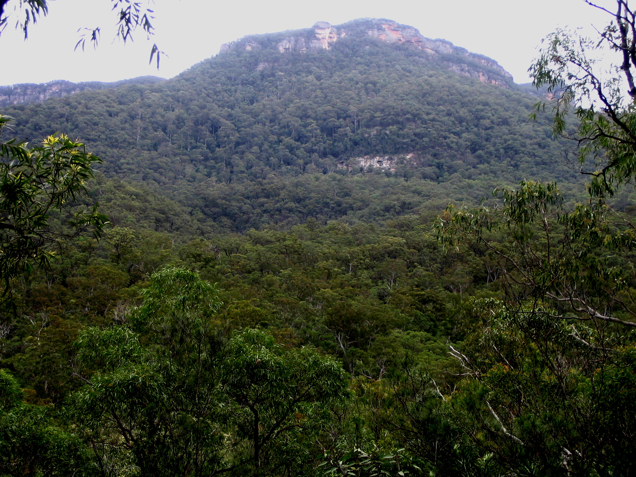
I caught the train up to Leura to meet my parents, and after a morning tea that consisted of an enormous flowerpot scone and the last coffee I'd have for a couple of days, I got them to give me a lift to the top of the Golden Stairs. These are a steep but pretty easy descent to the Federal Pass, and the flat to the bottom of the Ruined Castle is as easy a walk as one will find in the Blue Mountains. The scramble up to the ridge is mercifully short and quite worthwhile. At some point around here the drizzle set in, continuing on and off for the rest of the day.
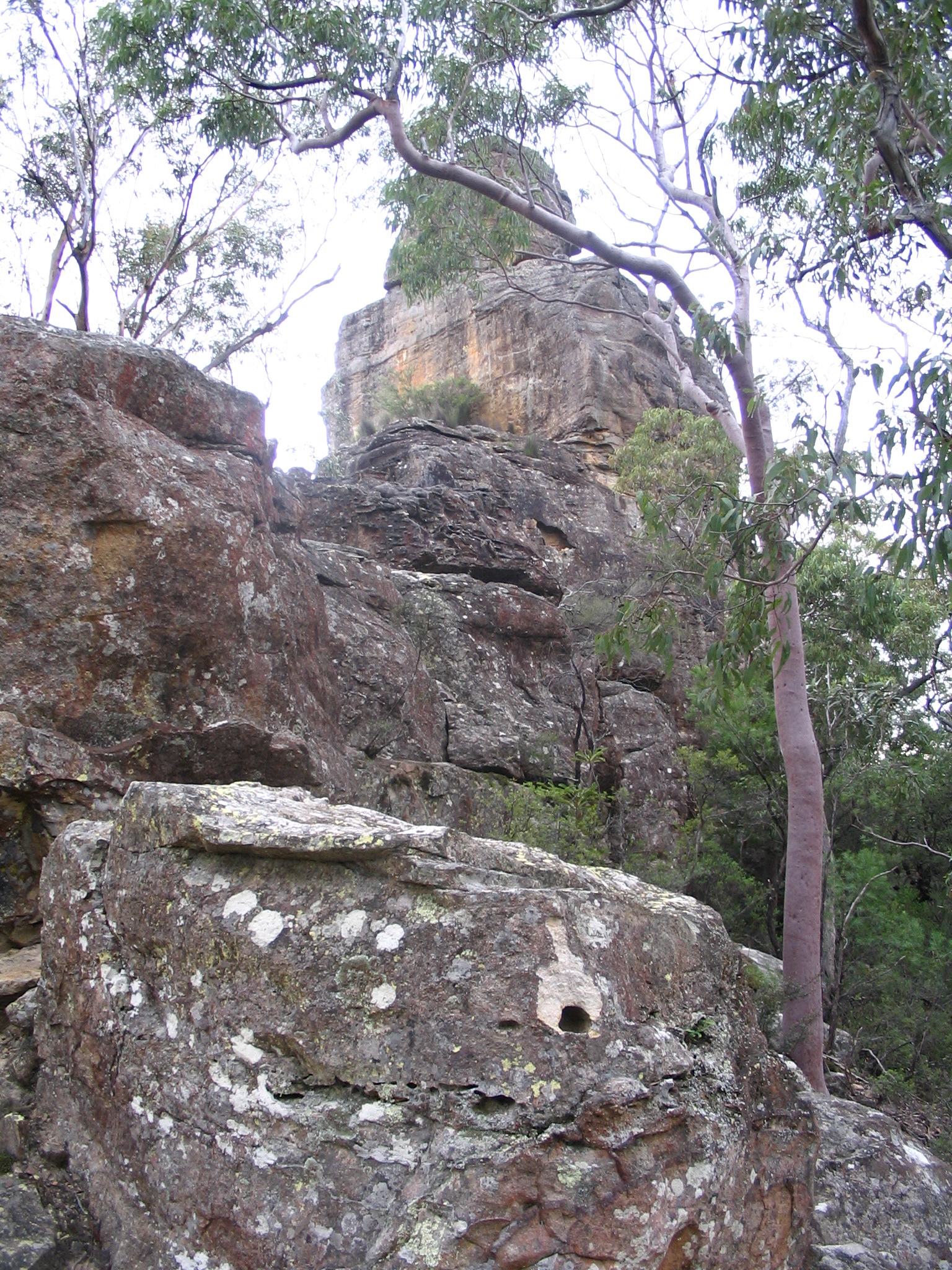
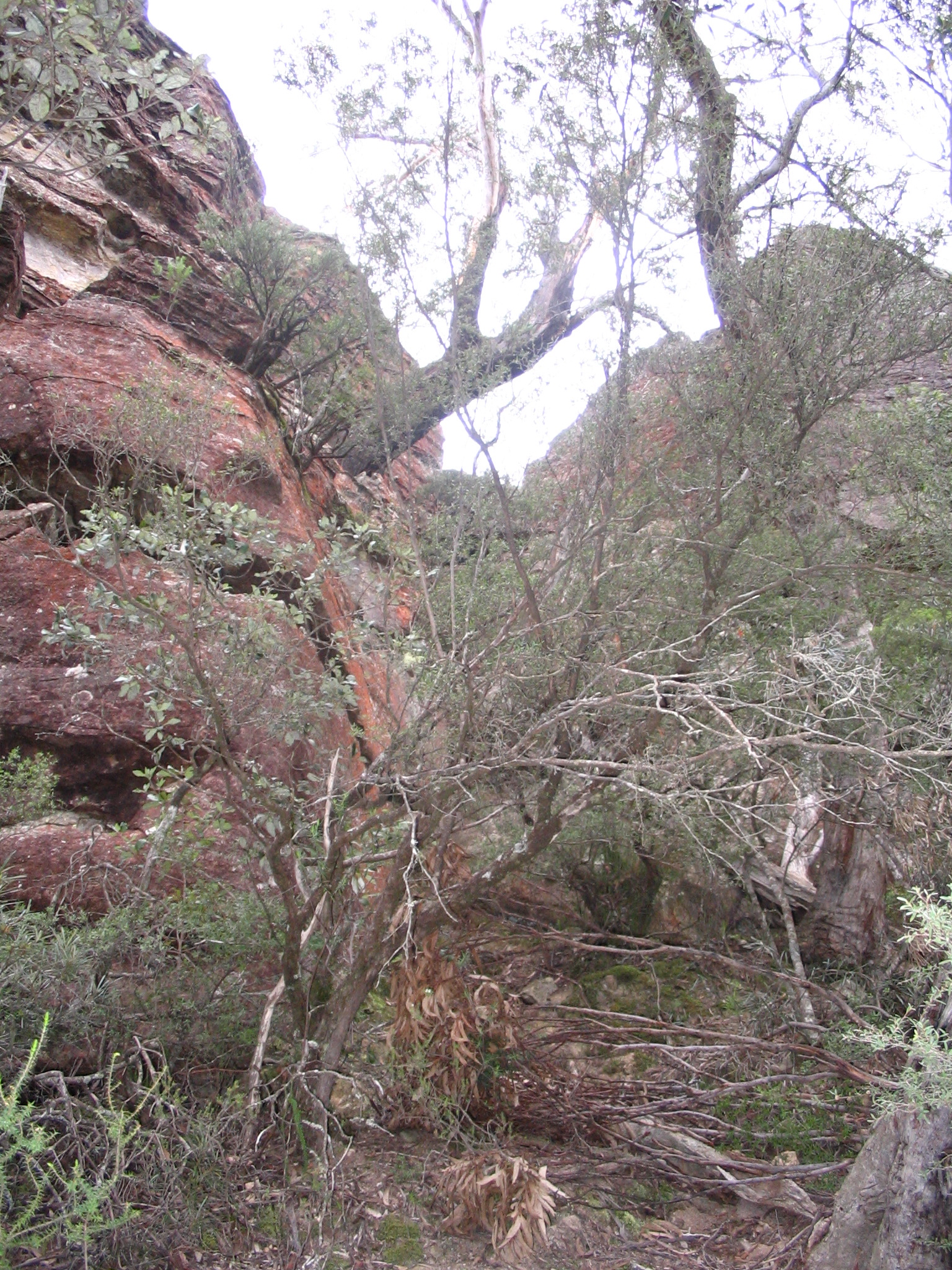
I was all geared up for a physically challenging descent at the eastern end of Mt Solitary, and so I was expecting the western approach (the Koorowall Knife-edge) to be about as hard as all that had come before, i.e. only making me wish I got more cardiovascular exercise more regularly. To my surprise the scrambles went on for quite a while, requiring one to climb about as many metres up as forward. Fortunately I am about as coordinated with the pack as I am without, and that proved adequate, and I'm always ready to take a spell (of work or rest, as need be). By this point all the time estimates people had given me had slipped on by, but as I'd multiplied them all by two anyway I had plenty of sun left.
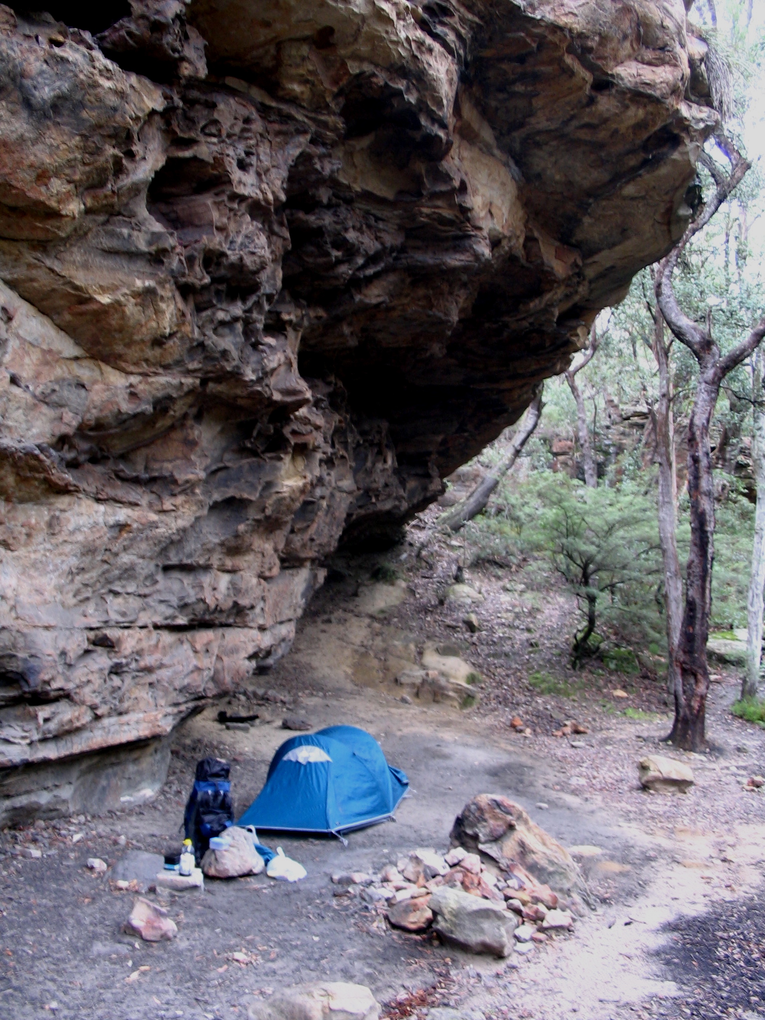
At some point the going-forward track dead-ended on the southern side of the mountain, but a small backtrack, some swearing and a steep hike got me to the first summit mentioned in the cheat-sheet. I pushed on for what felt like an age to Chinaman's Gully and set up under one of the underhangs. (There are truckloads of campsites on this route, complete with stone fireplaces.) Vodafone covered most of the walking trail, and so I spent some time nattering with Dave when the darkness properly kicked in.
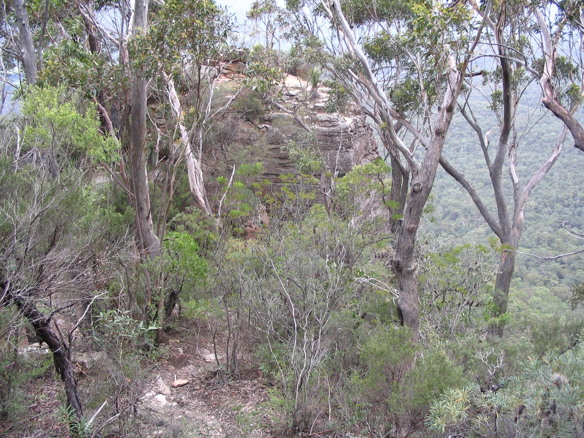
After a very slow start the next morning I had a pleasant walk along the ridge which had some great views back to Katoomba, though I couldn't see much of the Three Sisters as they stand in line, pretty much directly north. Indeed, the haze and rain put paid to any decent photos from this trip. The more adventurous or energetic could probably climb the summit with little trouble, but I was preoccupied by what was in the offing. Continuing to the Col I made my mark in the log book and contemplated the descent to the Kedumba River. Suffice it to say that yep, it's steep, but I reckon it was easier than trying to go back down the western side with a pack on.
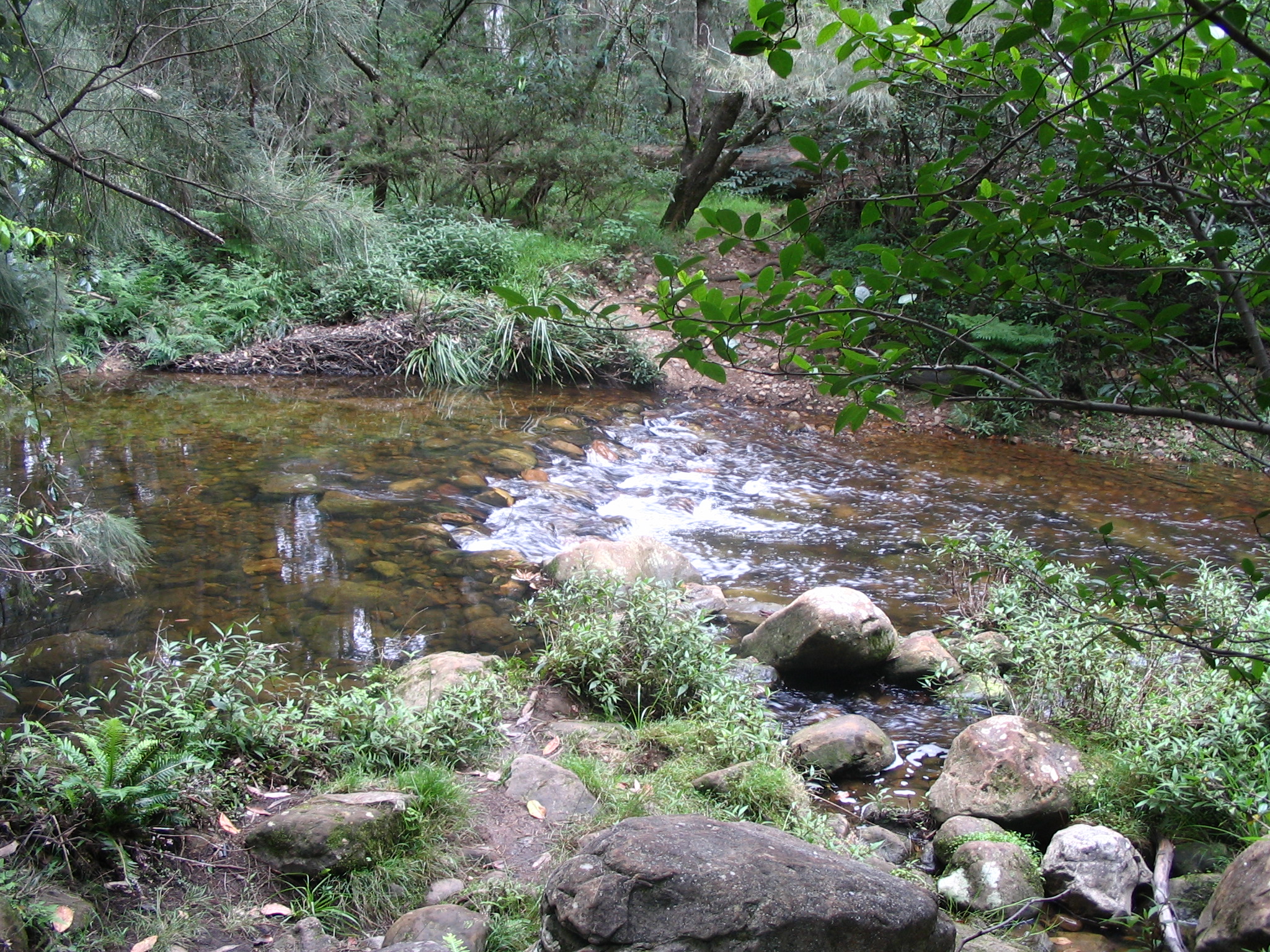
Again the rain started up while I was trudging along the Mt Solitary Walking Trail, abating by the time I got to the Kedumba River crossing. Due to the rain it was flowing quite rapidly, and I took the opportunity to refill my 2.4L Berri Apple and Pear Juice container (thanks, parents) and try out these water purification tablets. The result was some chemical-smelling but perfectly fresh-tasting water that didn't make me crook. Lunch was a Heinz Chunky Butter Chicken, which is just fabulous if you're eating to live. (Dinner had been their Rogan Josh.)
From the other side of the river the trail goes straight to a fire trail that leads to Kedumba Pass. An apple and a quarter-block of dark chocolate got me up the Victoria Pass-steep road in double quick time, arriving at the defunct Queen Victoria Memorial Hospital in something like an hour. I've got to find more things to do while I wait for my heart to slow down. The rain set in again, I was buggered and it seemed like a good idea if civilisation came to me in the form of an amiable cabbie. Had a beer at the pub at Wentworth Falls and was kept awake by the inane chatter of youths on the train back to Central.
In short: navigation was pretty easy, or as one guy remarked: "it's a highway". I had the Jamison Valley topo map recommended by the cheat-sheet; the Katoomba one is not very helpful as it only covers the very start of the trip which is signposted anyway. The views are great, especially on the southern side. The Docs are not the best hiking boots ever. Kathmandu really should make a big-as-can-be water bladder for their GluonTM system.
Iain is presently working at Kathmandu, and they're presently having a massive sale... ergo, I bought some gear. (The sale was a lucky coincidence, I was really there for Iain's expertise.) Here we go:
- A Vanguard v4 Rucksack with a daypack.
- A silk sleeping bag liner.
- A microfibre towel, and we'll see how much skin that takes off.
- A self-inflating mat
Suffice it to say I am well pleased. Now, to get all the other gear together... and see how far I can walk with it on.
Drove into Swan Hill with a hankering for some Maccas hotcakes (pancakes) for breakfast only to find they remain Maccas free. Settled for some pricey bacon, eggs, two coffees and an orange juice from an wannabe upmarket café. The waitress-barista at least had the pride to diss me for trying to explain a macciatto to her; in my defence I observe it is still short-or-long-macciatto land and she didn't get it right anyway (not quite enough cold milk). Better than the typical mini-cappuccino in any case.
After that I headed back to Orange to visit my parents for a bit. Took all day, about 600km through Deniliquen (bought some honey), West Wyalong (a coffee), Forbes, mostly signposted at 110km/h on single-carriageway highways. It is strange to be driving on the roads I learnt on as they are indeed as bad as any of the others on this trip.
Day 13: Mildura, Robinvale, Nyah State Forest, Murray River.
Mon, Jan 22, 2007./travels/2007-01-GOR-Murray | Link
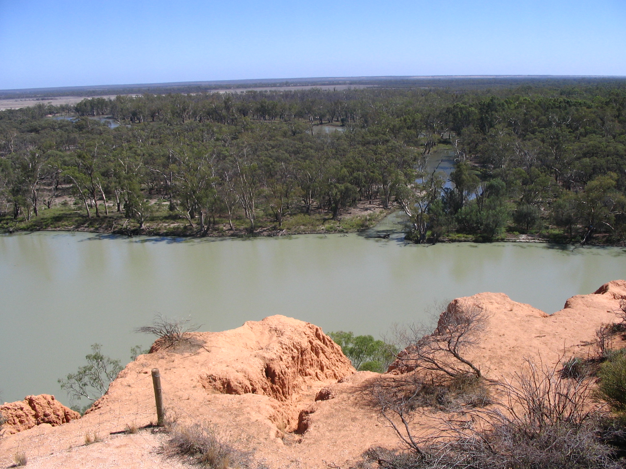
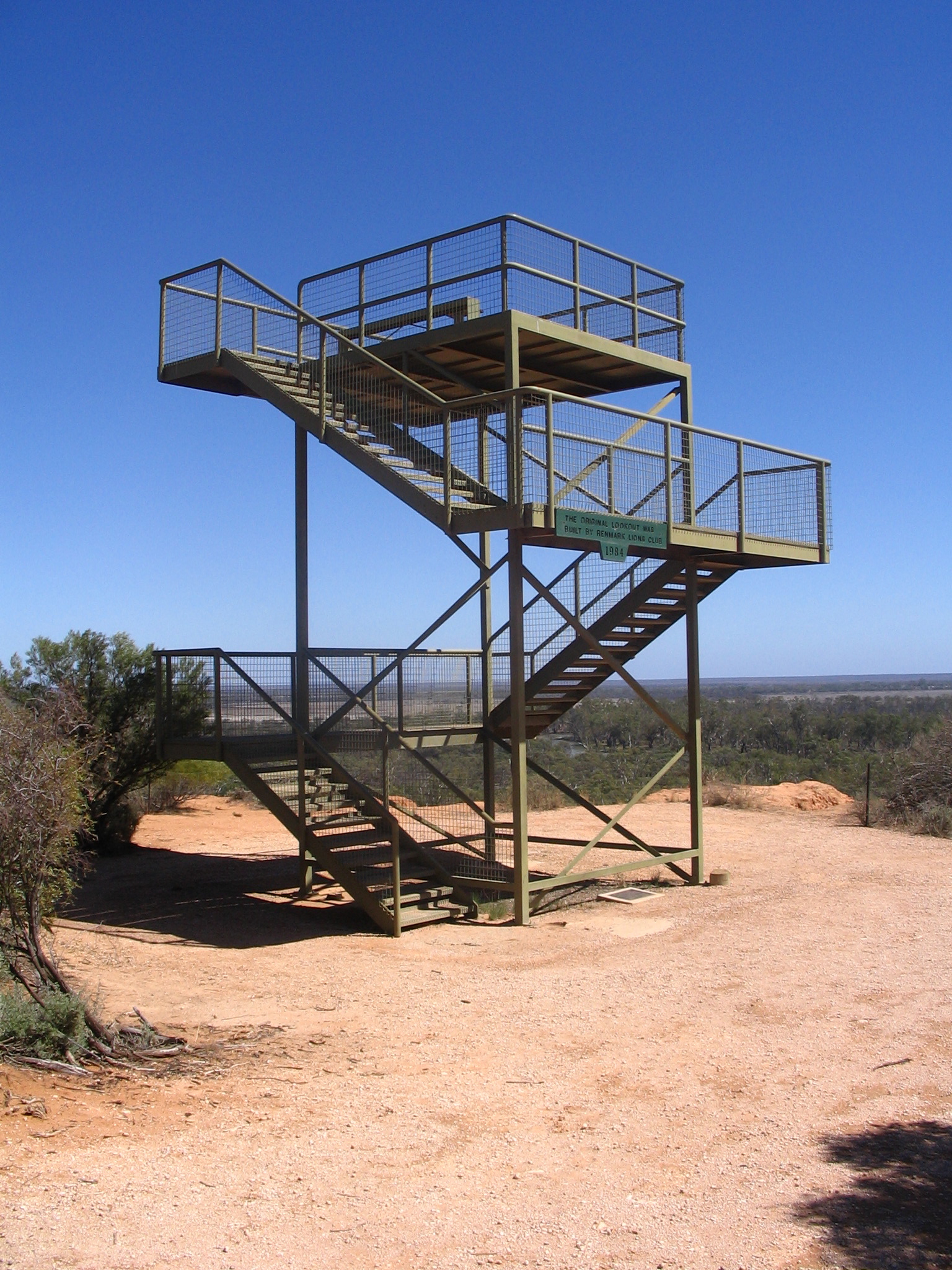
Blue skies once again, hope the rain made it to Orange and further east. Had a quick swim in the morning. The Murray River is quite placid at this point in the Murtho State Forest. Strangely enough there were a veritable forest of succulents just next to the access road. Views from Headings Lookout:
Drove to Mildura, about 150km along the Sturt Highway. It's still 110km/h even into Victoria, but drops back to a Victorian (and NSW) standard 100km/h east of a little farming town near Mildura. The lady who served me lunch said she hadn't been asked for a Neenish Tart for several years. Mildura itself is a not-too-exciting relatively big river town on the right side of the border. The Sturt Highway slips briefly into New South Wales between Mildura and Robinvale, where (shouldered, single-carriageway) it returns to the breakneck 110km/h through endless mallee.
Got some water from the friendly CFA in Robinvale, drove on to the Nyah State Forest, near Swan Hill, for a late afternoon swim and to camp for the night. The river is fairly strong here so swimming is hard work; fortunately there are quite a few tree limbs in the water to hang on to, or even sit on. There's plenty of Major Mitchell campsites along the Murray Valley Highway, including one at the point were the Murray and Murrumbidgee join.
One thing I've failed to learn about campsites is proximity to the highway. Here I'm a good half-kilometre away but the trucks' noise covers that distance easily. Another is proximity to the township. A bunch of people decided to have a small party in the bush tonight. Fortunately they were not from a hoop-cutting tribe.
My only major criticism of the Camping in Australia (Cathy Savage, Craig Lewis) is that it splits things up by state and region, so when trying to find a campsite e.g. near the Murray River one needs to check about three different maps that are not cross-referenced. Similarly I tend to grab too many of the otherwise-excellent Parks Victoria information sheets as I cannot readily determine if they are about where I'm going or where I've been.
(In case anyone is wondering about the car, tent and river photos: there was a restaurant in Göteborg — "the Thai place" on Eklandagatan — that had a truckload of beautiful landscapes with solitary mysterious tents in them.)
Got up at 8:30am New South Wales time, had breakfast and did my laundy at the hostel. I asked the guy at the front desk whether it was worth heading back down to Murray Bridge and Bordertown rather than up to Gawler, and he gave me an emphatic "nope". Expanding, I told him RJL Hawke was born in Bordertown and they'd built a commemorative museum. He responded, "Well, if you go looking you'll find something, but most normal Australians would say there's nothing to see."
Had a second breakfast with An at Passatempo on Gouger St, near Chinatown. Adelaide doesn't really get moving until at least 11am on Sundays, which An reckoned was much better than Perth. We walked over to the info centre on Rundell St and I got the same advice as before: don't stop, head for the border. I think one needs good reasons to be in South Australia.
Just in time I remembered being told that the Botanic Gardens were worth a visit, so An and I drove over there and plodded around for an hour. Indeed, they're very beautiful, so much so that they need to rein it in with News Ltd. sponsorship of the lushest fig-lined corridor. The refurbished Palm House is full of amazing Madagascan arid-climate plants, and the nearby cactus and succulent outdoor bed is pretty cool too. Drove around North Adelaide a bit, where there's not much to see apart from some very fancy houses. We had to do some detouring to avoid the last stage of the Tour Down Under. Headed up to Mt Lofty in the Adelaide Hills but couldn't see anything due to a thick mist. (Come to Adelaide, it's winter in summer.) Dropped An at the State Library and made for the Sturt Highway, to Renmark. It's easy to drive around Adelaide but precious few places to drive to.

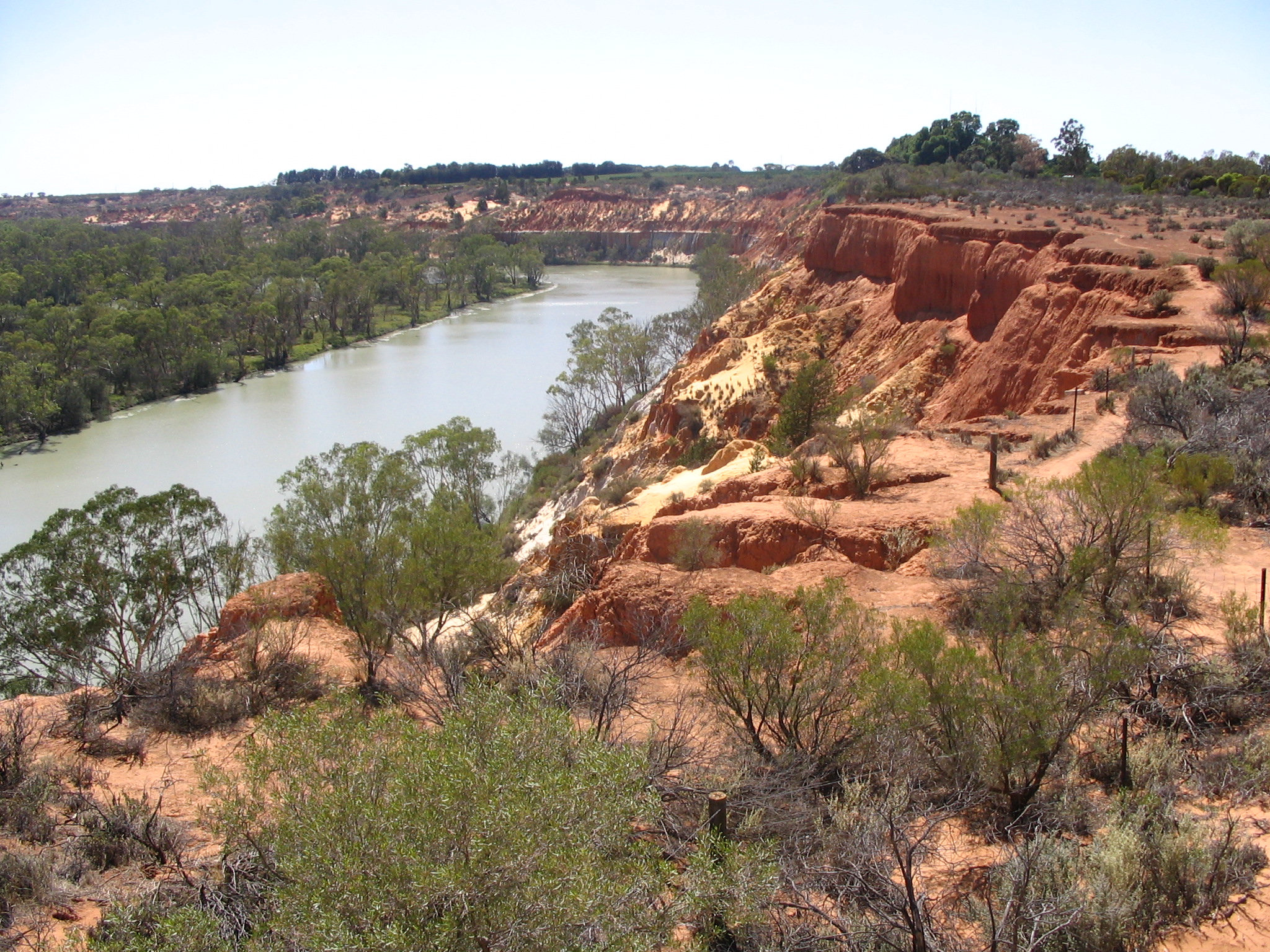
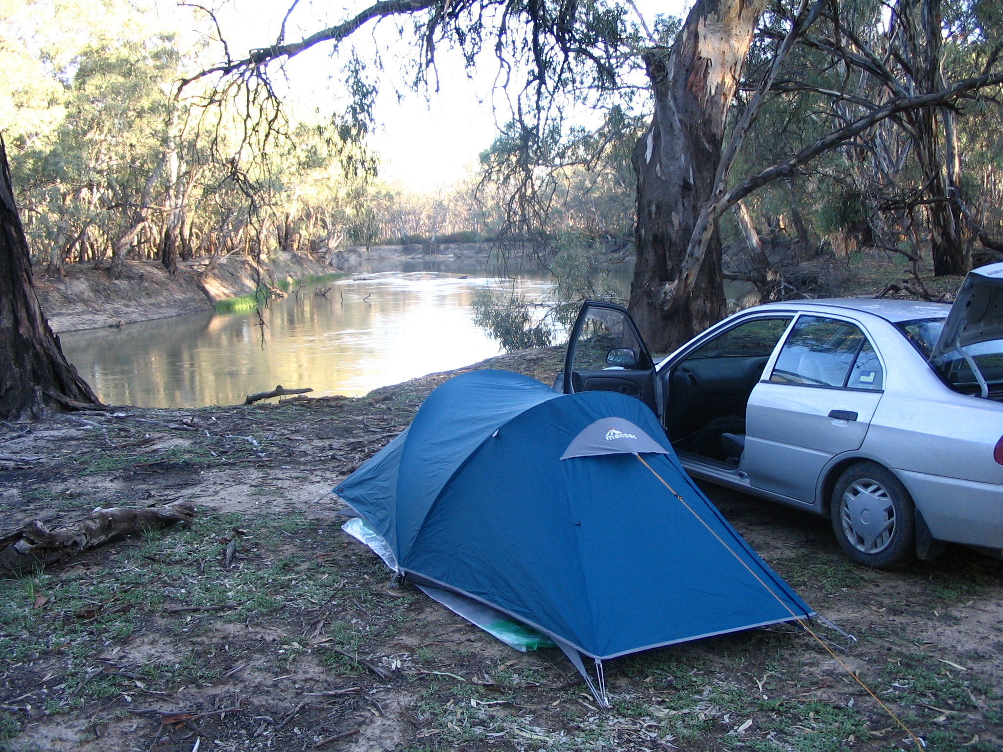
Approx 300km drive to the campsite in the Murtho State Forest promised by Camping in Australia (Cathy Savage, Craig Lewis). Very peaceful, no facilities. The river is very pretty around here. There are loads of vineyards even this far north.
Crappy weather all day, but the clouds broke in the evening.
Drove on to the River Port of Goolwa, the (purported) eastern gateway to the Fleurieu Peninsula. If I'd done more research I would have known this is the place to be: one can reeadily get to Hindmarsh Island and the Murray Mouth, and Kangaroo Island sits at the end of the peninsula. Suffice it to say that the good bits here are west of Meningie.
Goolwa was a river port, where goods carried on barges down the river were loaded onto the railway to an ocean port. Supposedly the railway is the oldest public one in Australia. Now it's all touristic.
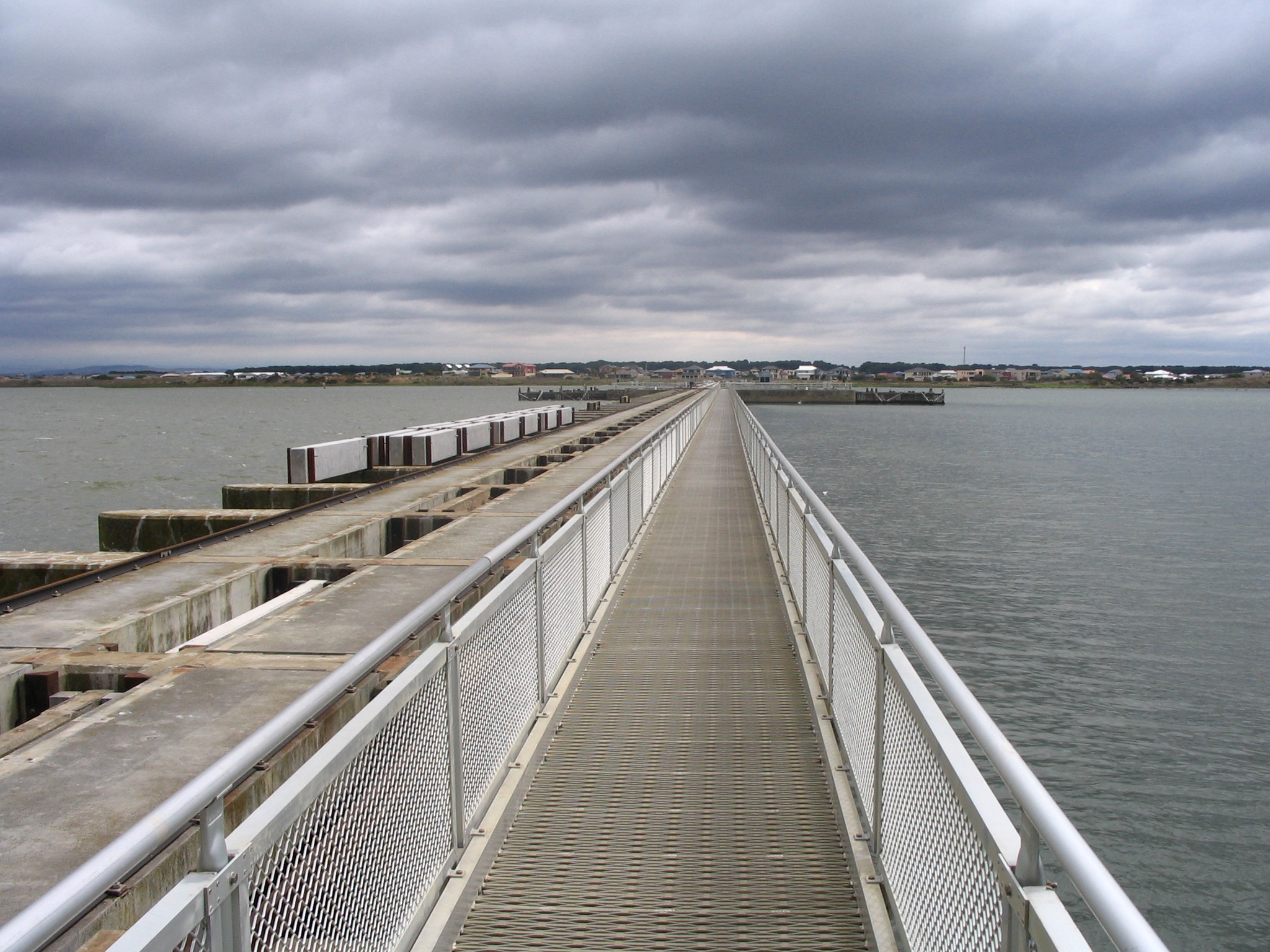
Drove to the Goolwa Barrage, then on to the boat launch. Walked from there to the Murray Mouth on the Sir Richard Peninsula. As the guy in the info centre said, yes, you can do that, but it's a long (three hour return) hard slog through some uninspiring scrub on an evasive track. It's the sort of thing only someone who'd never think of doing it could assent to.
This is the Murray Mouth from side on (Southern Ocean on the right, Lake Alexandrina on the left, Younghusband Peninsula straight on). The incoming waves exert more force than the freshwater from the river, and given the four-States-and-the-Feds politics involved, South Australia has decided to use Federal money to continuously dredge the Mouth so the Coorong gets the occasional flow.
I tried to cadge a lift back from the mouth from some fisherpeople but was rebuffed on the pretext of no space. They warned me off trying the ocean side, which I think was pretty self-evident given the wind, though perhaps not to me in my ennui-enervated state. A solitary brown snake was a little more friendly on the way back.
The touristic alternative to my hike is to drive through Hindmarsh Island and look at the Mouth from directly opposite. Note to self: drive first, then maybe walk. There's a new Marina Development designed to milk Adelaide's BMW / wine tour set, and some McMansioning west of that. I opportunistically and expensively grabbed some lunch at Bocca Bella's Café at the crossroads, housed in an old school building. Good food, effusive hosts.

This is the Murray Mouth from straight-on, and it's easy to imagine the Mouth when there was more water flow.
In this part of Australia all roads lead to (or equally, away from) Adelaide. I naively followed the signs that said "City" and before I knew it the Anzac Highway left me on their George Street equivalent. Perhaps Church Street is a better approximation as Adelaide seems quite like Parramatta to me. I found an internet café and quickly surmised that there was no theatre on in the near future; the town is hibernating in preparation for the all-consuming Festival. Similarly a lot of hostels appeared to be mostly full, though as usual there was a bed to be had, in this case in a ten-man dorm in the Shakespeare Hostel. Apparently they mostly cater for international uni students while they find somewhere to stay. Pretty standard as far as backpackers go.
Hit the world-famous Rundell St with An from Melbourne, a friend-for-the-night from the hostel, ending up at The Elephant (British) Bar on Fringe Alley. We reckon there's a man shortage in Adelaide, most men in town are cops, and there's a cop on every street.
Crap weather today, raining on and off with varying intensity all day. So what to do but drive around looking for things to look at?
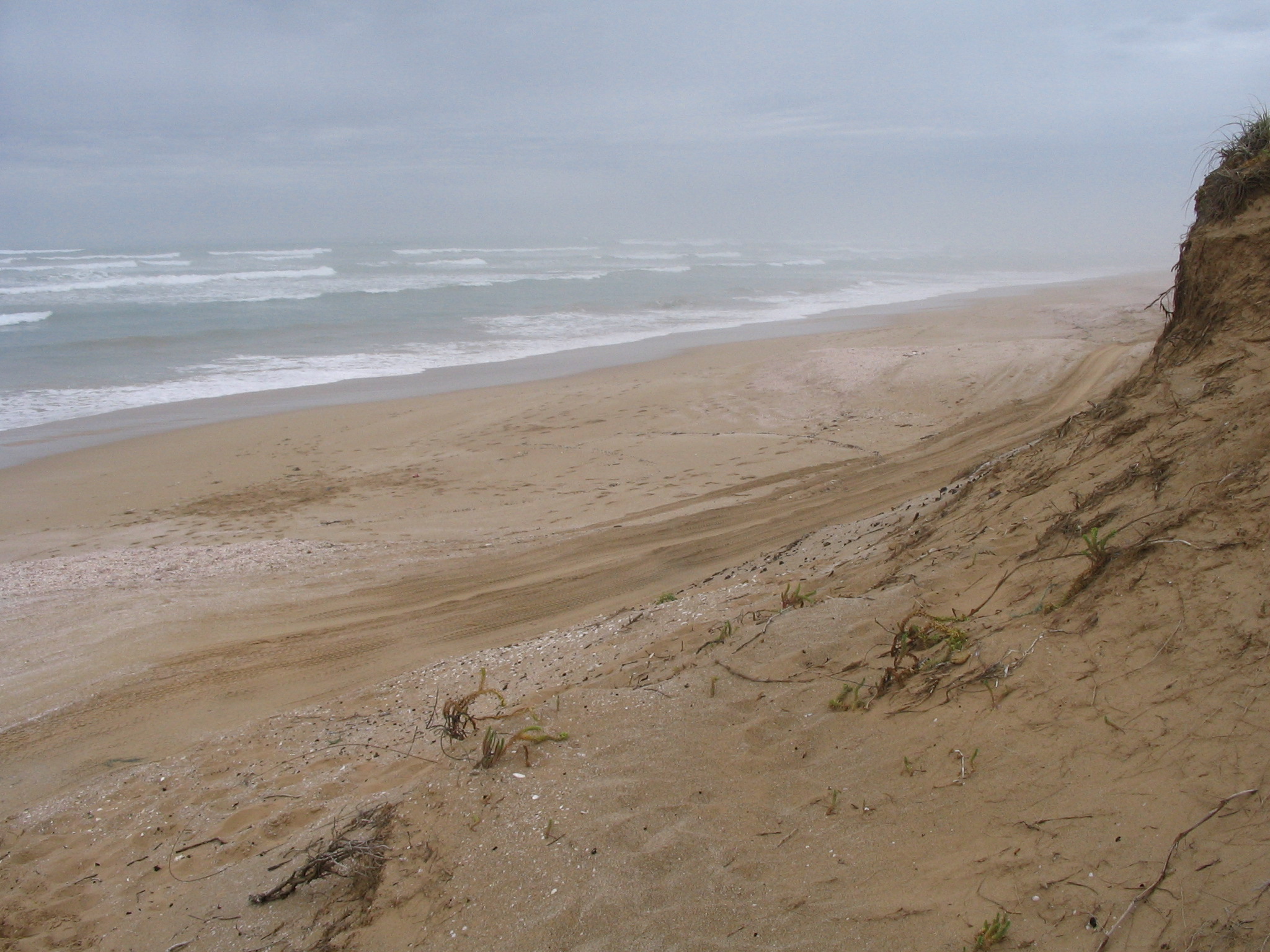
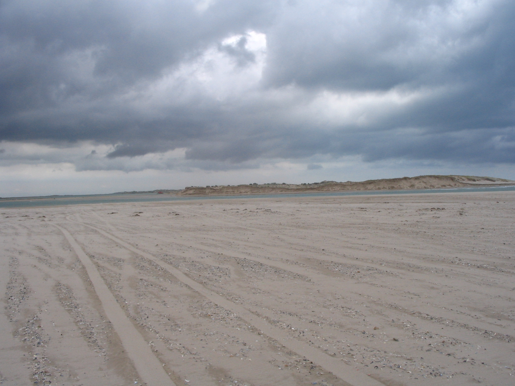
Walked to the beach at 42 Mile crossing, running into an emu and tourists along the (approx) 3km round-trip through sand dunes and scrub. This is the Southern Ocean beach at presumably high-tide at the end of the crossing. The 4WD track is indeed four-wheel-drive only.
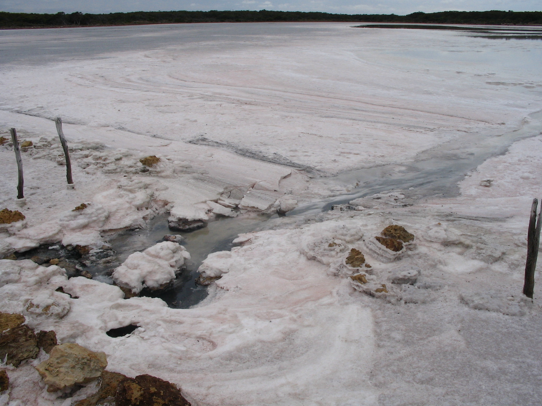
Drove up the Princes Highway a bit and got onto the Loop Road. Got onto some ad hoc section of the Lakes Nature Trail, trekking across the salt lake. The crystalline formations remind me of ice on the streets of Göteborg after a few days of snow and rain.
Remaining optimistic I drove around Lake Albert, down to Mark Point and as close to the barrages as one can get in a car. The rain turned me off doing any heroic walks. Returned to Meningie for some lunch via the car ferry that runs between the headlands separating the Albert and Alexandrina lakes.
After making it up to Meningie I concluded that the southern part of the Coorong is not so great without a 4WD vehicle, a boat or a fishing fetish; the scenery just isn't that inspiring.
With more reason to be optimistic I took the car ferry across the Murray to Wellington, and made my way down to Point Sturt in search of a campsite, only to find it quite exposed and ringed by private property. There are loads of vineyards down here.
Headed to Clayton, and got a campsite right on the Alexandrina at the very pleasant Clayton Bay Wetlands Caravan Park for fifteen dollars. In the night we got some heavy rain, thunder and lightning. Had some fish for dinner from Sails, the local café-restaurant, and I can't recommend the Murray Mullet. Another pretty little town.
Tried to find Picaninnie Ponds and completely failed. (There are precious few direct links between things out here.) Did find the Ewens Ponds, though. The South Australians have some strict-sounding but apparently unenforced policies, like snorkelling with a buddy and only six in the pond at once. I didn't bother getting into the water.
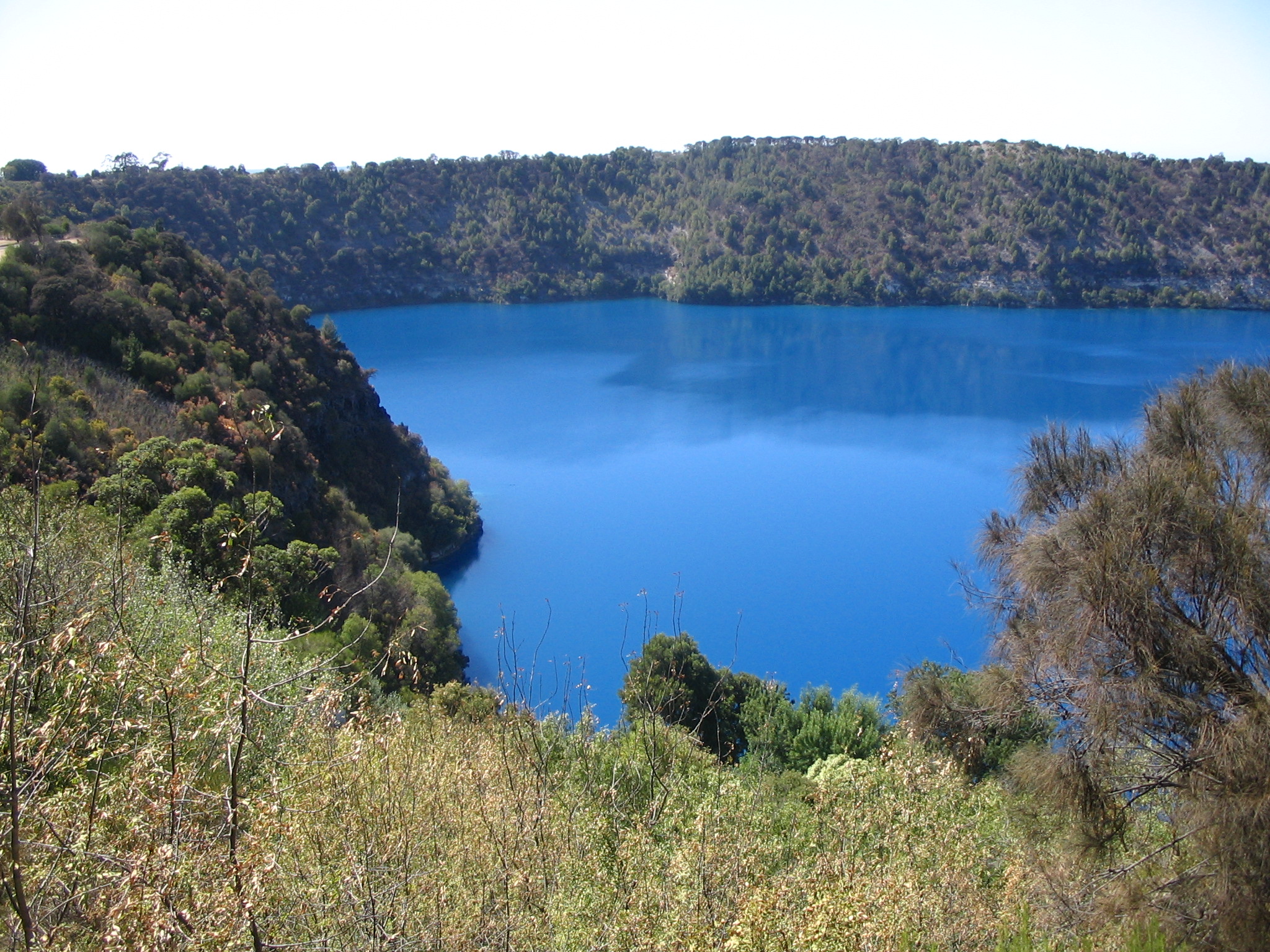
Drove on to Mt Gambier. For those heading east-to-west South Australia is kind enough to give one back half-an-hour of one's life, which some would say is quickly burnt by simply being in this State. This is the famous Blue Lake, which is just on the edge of town. It's the water supply so there's no swimming.
Lunch in Mt Gambier at the Jens Hotel. Wandered about trying to find the post office. Going west the roads turn into 110 km/h shoulderless wonders. Made a beeline for Beachport in the hope of getting a swim in before day's end, and had a dip in the Pool of Siloam there, a small kids' pool that is purportedly seven times saltier than the sea.
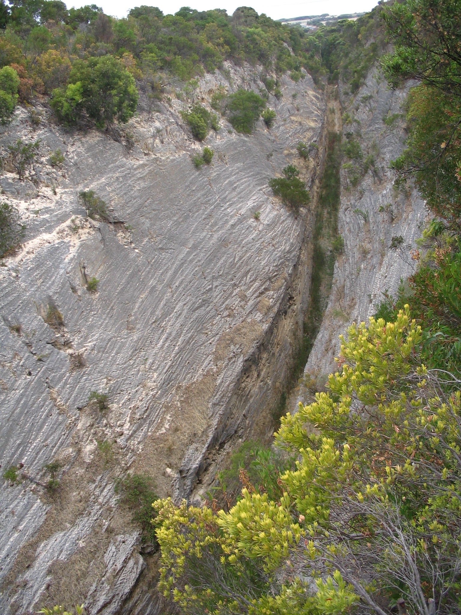
The Woakwine Cutting, just north of Beachport.

The big lobster in Kingston SE.

The Granites are South Australia's answer to Victoria's 12 Apostles. New South Wales is yet to enter the competition.
The Coorong is the overshoot from the lakes at the River Murray's mouth. I'd been keen to see it since I set eyes on a massive photograph in the transit lounge at Adelaide Airport. Apart from some idealised vision of the Murray Mouth I had no idea what I was getting into.
The Old Coorong Road is not signposted, at least from the south. I found 32 Mile Crossing by accident, and the signposted campsite looked quite dire or even absent, a big fenced-off bog. My maps proved hard to use, with some showing the roads and towns and others the facilities. I found the one in The Tattler to be the best despite it leaving out lots of roads. The area around Goolwa is quite well covered by the map from the information centre although it too does not cover all the roads.
I ended up camping at 42 Mile Crossing with about 10 other people. Got in around 7pm, too late to get a decent site, and so had to settle for a sandy spot directly opposite the self-register stall. It's four bucks for the night (per car, I think motorbikes get a discount). The mild rain was a bit of a bugger while pitching the tent, making me think I would struggle in proper rain. Conversely the car is enjoying the wash. It's very humid inside the tent.
As recommended by Parks Victoria, I tried booking a campsite in the Lower Glenelg National Park at the Nelson info centre but they weren't biting. Give it a shot, they say, can't imagine they're full.
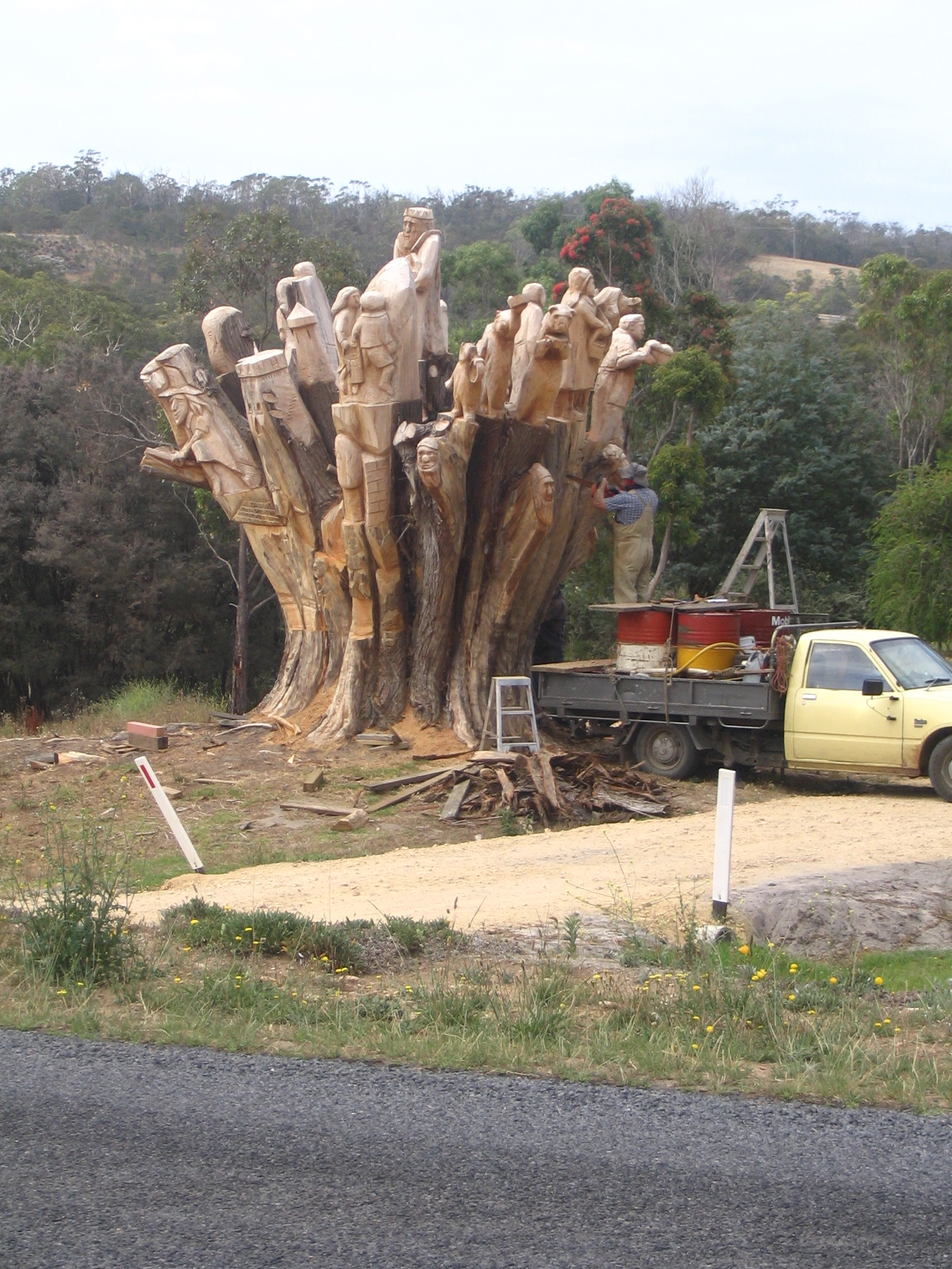
Went the long way around, avoiding South Australia: to Dartmoor, along some dirt roads, through pine plantations harbouring emus and kangaroos. The town is pretty dead: I sat in the coffee lounge at the general store for quite a while and no-one tried to sell me anything. The wood sculptures on the main street are quite cute, apparently representing some war veterans. Here's some guys sculpting with chainsaws.
Continuing the loop I found the Waterfall Gardens, a beautifully presented private property on Wanwin Road, fronting the Glenelg River. It's a bit pricey at five dollars for a walk and fifteen for two-thirds of a (good) lunch.

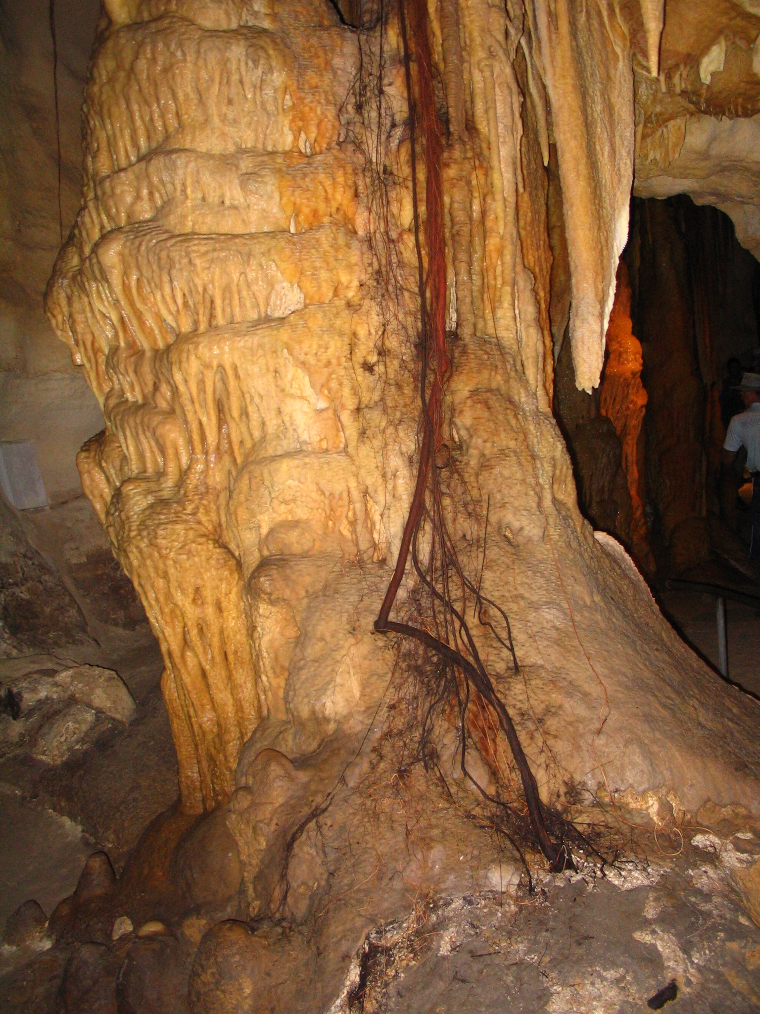
On to the Princess Margaret Rose Cave, which is a single limestone stream cave. There's a boat ride there from Nelson. All I can say is don't go on the 2:30pm tour, as that is when the boat gets in. The guide pointed out some tree roots going down twenty five metres and more in search of the water table. (The one with the green ribbon around it.) The area has subsided due to the overuse of the aquifer, manifesting as broken columns in the caves and a lowering of the Blue Lake at Mount Gambier by two metres in twenty five years. Ironically the whole Cave area uses (undrinkable) bore water.
Once again the Smage has been there before me and has all the vital statistics.
Swam in the Glenelg near the jetty there. Almost no current, few boats, quite peaceful. Jetties are not as useful as boat launches for getting into and out of the water. The idea is to avoid a scramble up a muddy river bank, which is where a concrete boat launch is most helpful.
The campsites at the Cave are fairly pleasant, though the choices seemed to be between ones they were watering and ones with loads of ant nests. There's a single hot shower for each sex, and no potable water. The damage is fourteen bucks a night, which (I now realise) is cheap for several people. A little blue wren joined me for dinner, the bulk of which was Heinz's Butter Chicken soup, not bad keep-alive food.
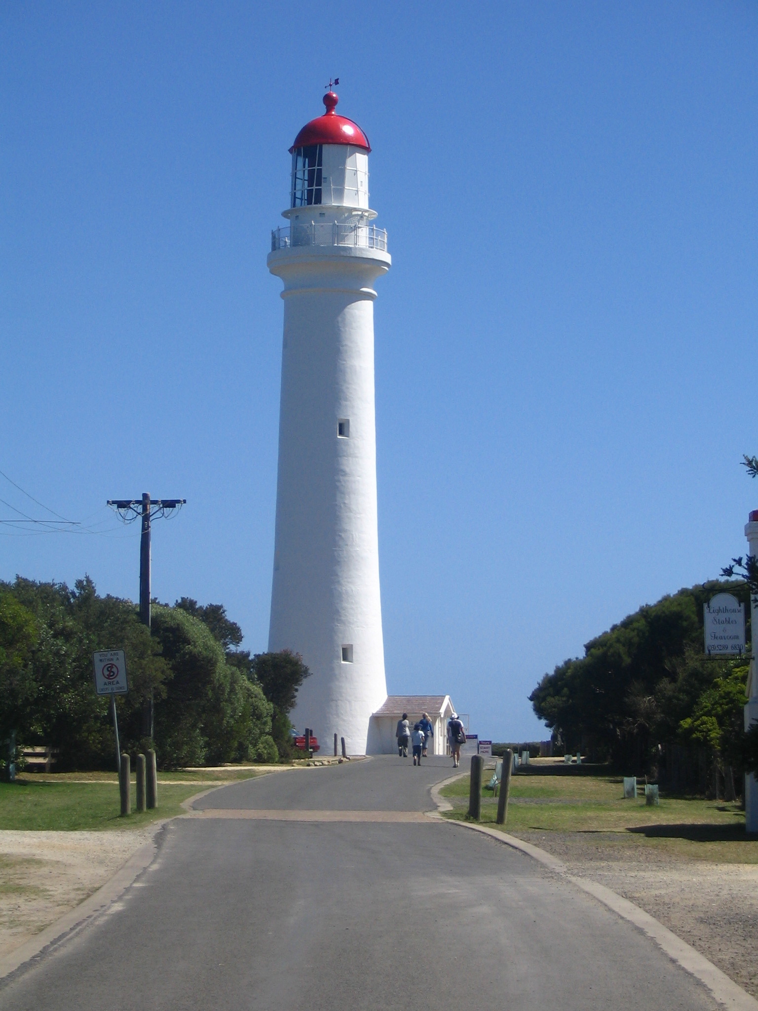
Slow start. Wow, free wireless on the main drag of Port Fairy (just out the front of The Juice Port). Had a decent coffee at Ramella's. Walked around Griffith Island (lighthouse on the far corner, otherwise a nondescript scrubby sand-dune and bluestone bird sanctuary) and had a quick swim at the Eastern Beach, which was packed. The Victorians put the flags right next to each other and only have one set per beach, not so effective when there is four kilometres of not-so-large surf.
Drove on to Portland, another big city on the Great Ocean Road. Got sidetracked into looking at a fishing spot on the Fitzroy River, but didn't stay long as the stomach was rumbling. I'm really spoilt for choice now with several beautiful spots coming up — the Glenelg River and the Discovery Bay, and all that stuff beyond Mount Gambier.
There's a big windfarm between Port Fairy and Portland, most of which seemed idle. If the little coupling to the grid near the road is for the whole lot of them then it seems to be a lot of engineering for little energy.
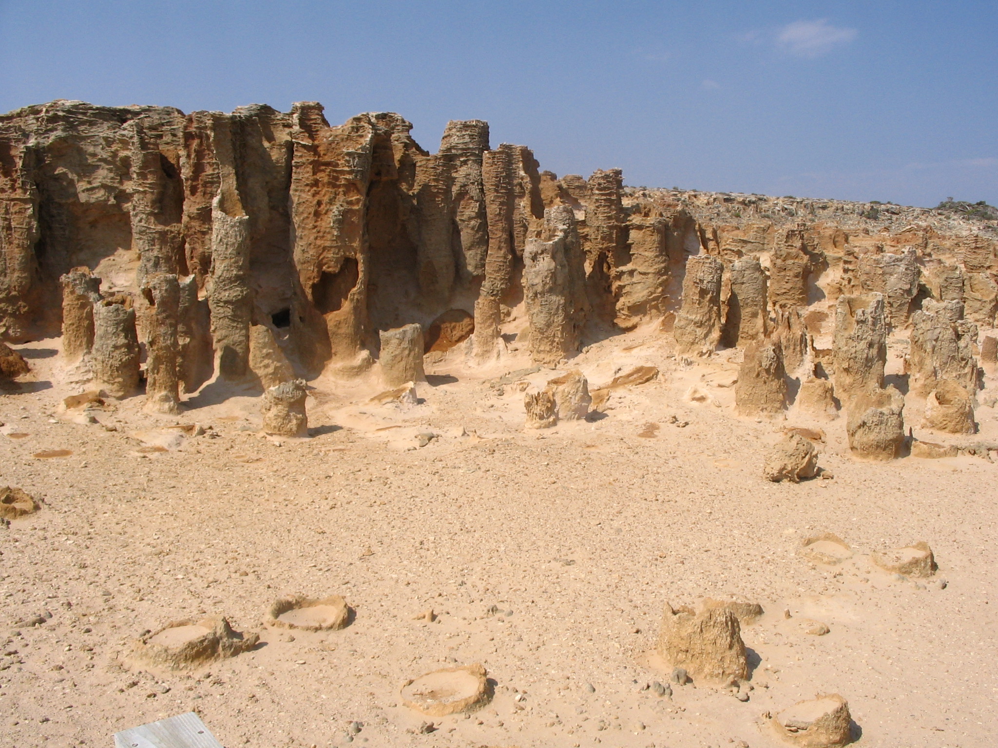
Grabbed some lunch at a little café near the bay in Portland, and then had a snorkel off the breakwater on the advice of the very helpful young lady in the info centre there. It's a popular spot for fishing and is quite calm, and indeed there were some fish to be seen. Drove over to the picturesque microtown of Bridgewater for a swim ("One of the (few?) best beaches in Victoria" according to the aforementioned young lady), and hence up to the peninsula to see the seal colony, which turned out to be a two hour hike too far. This is the Petrified Forest ("it's like the surface of the Moon" said the lady in the Port Fairy info centre) and I didn't really see the promised blowhole. This is all part of the Discovery Bay Coastal Park.
After that I made a beeline to Nelson, which is the end of the Great Ocean Road according to the official touring map. I had hoped to spend the night in the Lower Glenelg National Park but had left it a bit late to acquire the requisite permit. Luckily I got a pseudo-site in the picturesque, tiny, secluded and convenient River Vu caravan park, right on the river. (While it was nominally full the French-Canadian hostess allowed me to pitch my small tent on a cheap non-site in the picnic-table area.) Went for a lazy freshwater paddle at the estuary beach on the Oxbow, which is really a kid's beach and suffering somewhat from the drought. Had a few beers and a snapper for dinner at the Nelson Hotel. Talked a bit with some older Melbournians out on a tour, was a banquet to many mosquitoes. A really beautiful little town. (The Smage review is a bit out-of-date. There is an info centre there.)
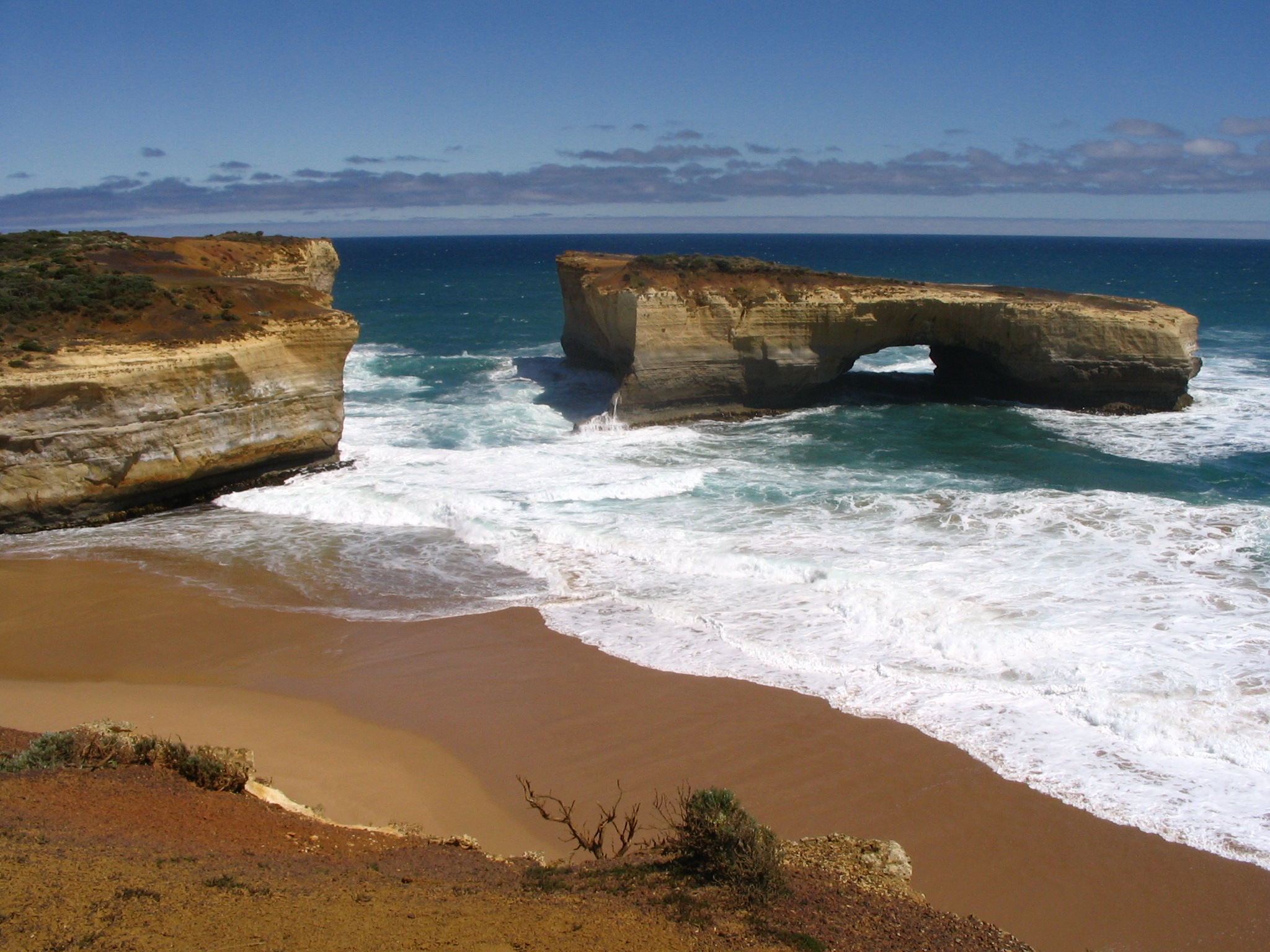
Despite what the map claims or a Victorian might tell you, the Great Ocean Road really only goes from Torquay to Apollo Bay. After that it goes inland behind Cape Otway and mostly stays there, apart from the satellite stretch around Port Campbell, home to the many Sydney Unis worth of formations that are some of the major attractions along the road. (This is all that's left of London Bridge since its collapse in 1990.) By the time one gets to Princetown it's just another name for the big fat Princes Highway (A1) running between Mount Gambier and Geelong.
Walked a bit around the Cape. Drove up to the Otway Fly Tree Top Walk, but at twenty dollars for an hour-and-a-half, signposted at the absolute last minute, I gave it a miss. Drove further down the dirt road into the National Park for a free walk to the Triplet Falls through some quite beautiful rainforest. It pays to study the guide a bit more — if I'd gone to Lake Elizabeth there's a chance I might have seen a platypus on this trip.
Lunch in Port Campbell, where one can park right on the beach. Tried snorkelling there but failed to sight any fish. For the first time this year I donned my spring suit, though it turned out to be superfluous.
Stopped off at a random subset of the limestone formations. Supposedly there's a penguin colony at London Bridge (now Arch) but I wasn't there at the right time to see them.
Took the back road to Warrnambool, ended up at the mouth of the Hopkins River at Logan's Beach. It's a big town and lacks the holiday / country feel of the others on the Great Ocean Road. Tried swimming at the main beach but didn't last long due to the seaweed and ennui.
Drove on to Port Fairy, took the cheapest caravan park in the book from the info centre, the Catalina Park. It said fifteen bucks but they wanted twenty-two (the discrepancy due to it being the high season), we settled on twenty. For me it's just paying to take a shower and perhaps use the cooking facilities. Cheap means its right on the highway, so I've gone from the sublime surf-crashing-into-the-cliff to the truckers grinding their gears into town.
Am incubating Peodair and Rachel's flu quite successfully. Spoke with Mum and Dad briefly on the phone; Dad had had an adventure getting back from Inverell to Orange on public transport.
Bernie drove us back to Anglesea for breakfast at a decent café in the middle of town. I had some lunch in the holiday park, not much more than a snack. Decided to push on to the Otway National Park today in spite of (compulsorily) having paid for the campsite for this evening too. Had a dip at the beach at Lorne on the way, not much more than a kiddie's pool, and at Apollo Bay, which is quite a picturesque town. Had dinner at the Great Ocean Hotel at the western end of it.
It seems the hitherto fine weather might be coming to a close; similarly to last time I was here (with Lev in Easter 2000), there's a fat band of high cloud taking up most of the sky. We got some light rain but nothing too inconvenient.
Following the map I tried to camp at Cape Otway itself, but the joint was closed. (The campsite was marked "Cape Otway GOW Campsite" and I now realise "GOW" stands for Great Ocean Walk — so it's probably only accessible by hard slog.) Backtracking I made my way towards the Parker Hill and Blanket Bay campsites and took a fortuitous turn down to Point Franklin, a beautiful little campsite with a great view of the Lighthouse. It's not on the Parks Victoria map and not signposted for camping until one arrives. (Camping in Australia (Cathy Savage, Craig Lewis) does mention it, however.) Supposedly there's a charge for driving in and also for camping, but no ranger tried collecting money from me. Perhaps if one turns up after 7pm or so...
I got bogged taking the high road over a little hillock into this perfect little hollow, landing the Lancer's low underbelly on the peak; I didn't remember what low wheel clearance she's got. With the help of some swearing and my fellow campers Mark, Timmy (his wife, from Hungary) and her mother, we managed to get the Lancer back onto the flat. Lesson learnt: use sticks rather than rocks, as they don't tend to slide out so readily, and that the low road is there for a reason.
When I was here with Lev we managed to flatten the hire car's battery, so I reckon this place is cursed despite (or because of) its incredible beauty. The Cape marks the end of the Surf Coast and the beginning of the Shipwreck Coast, where I hope there's some snorkelling to be had.
Breakfast at a pretty crap café roughly opposite the holiday park; expensive and the food wasn't so great. This trip is going to bankrupt me. Bernie, Hui Nee, Peodair and I headed down to the beach just east of the Split Rock Lighthouse for a paddle. After some flaffing about we had some lunch with Rachel, apparently mostly recovered from her malady, at a fish and/or chip shop in the heart of Aireys. I went for a walk around the Lighthouse.
Headed over to Fairhaven beach for a mid-afternoon swim; Bernie was enjoying himself immensely, while Peodair managed to turn himself into a poor facsimile of the English flag. Went to the Lorne Hotel, about 20kms east, for dinner. Lorne is roughly at the limit of what people from Melbourne are prepared to drive for a weekend away, so there are plenty of expensive cafés, restaurants, bed-and-breakasts, etc. there.
Back to Aireys Inlet Holiday Park for a sleep.
Had a late breakfast with Bernie at the Groove Train on Bridge Road. Went back to the mechanic as the wheel alignment on his car isn't right (and still isn't). Bernie attempted to rotate the tyres with mixed success.
Headed off to Aireys Inlet in the mid-afternoon. It's a little holiday town near the start of the Great Ocean Road. Took ages to get through Geelong due to a crash, apparently some rear-ending. Aireys Inlet Holiday Park is schmick enough, though they charge for everything; we're paying for five people for three nights even though Rachel didn't make it down today and we're only staying for two.
Late-afternoon swim at Fairhaven, out the front of the surf life saving club. Decent surf and the water is not that much colder than Coogee in early spring. Most people wear wetsuits of some form or other. Some surfers had some success.
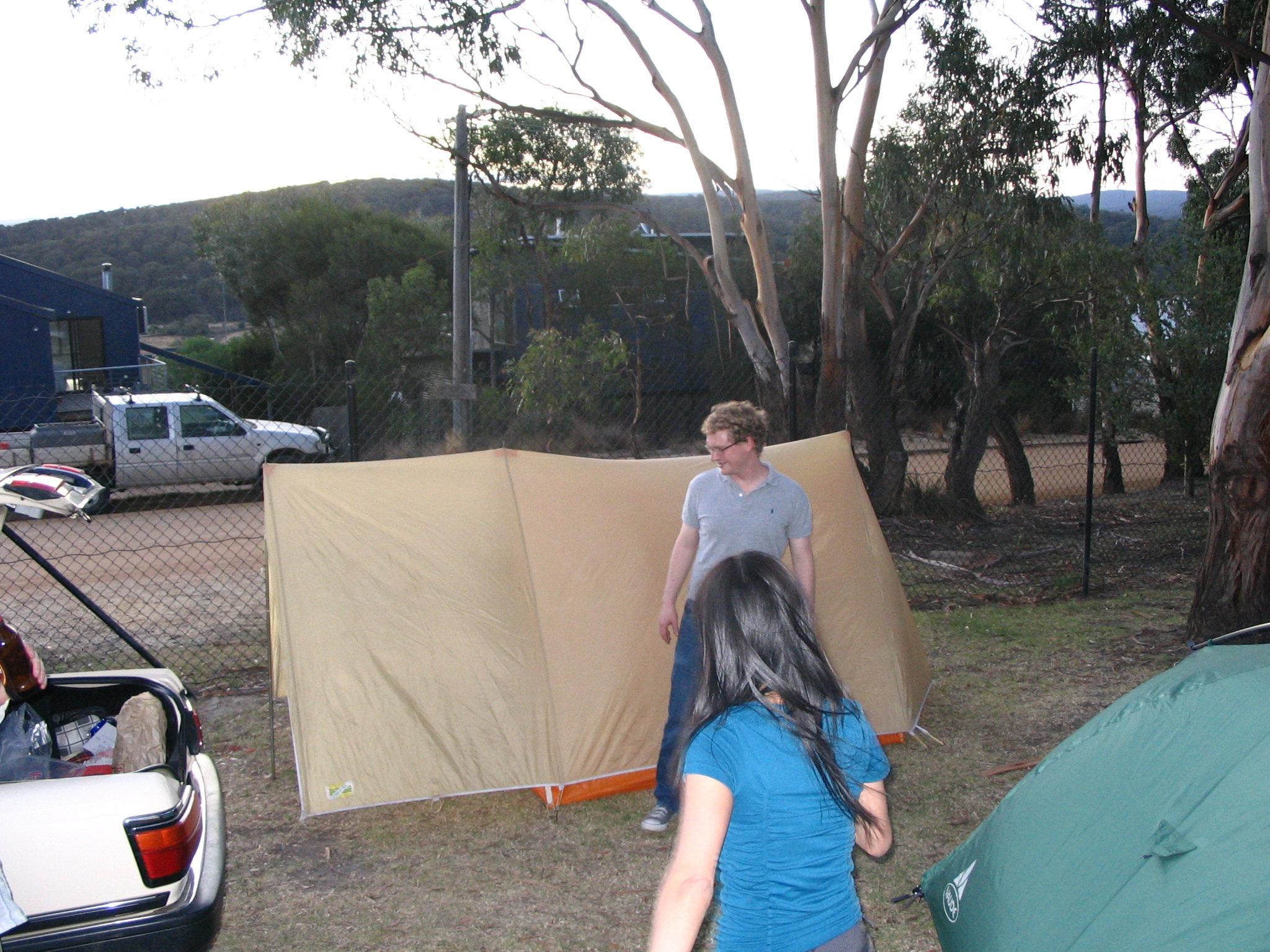
Bernie, Hui Nee and Peodair came down around 8pm and loads of fun ensued trying to erect the tents. Pitching Peodair's TrendSetter love shack required careful attention be paid to the oral traditions of the Leihy tribe. We spent the night in the local pub, The Inlet.
Got up around 8:30am and took about an hour and a half to slowly get my stuff together. Drove in search of Lake Mokoan with little success, and bypassed Glenrowan by accident. Ended up in Benalla (an almost-perfect sounding town for me) where the kind lady in the info centre directed me to a nice spot for a dip in Lake Benalla. No current, quite warm (at the surface at least). (Contrast to Gandagai, where the lady was worried I'd sue her if she gave me the same sort of advice!)
Someone (Bracks? Kennett?) has gone through these northern-Victorian towns and beautified their main streets according to a banalification masterplan. The road is two lanes wide, with a dedicated right-turn lane. Careful pedestrians can block the intersection by crossing in front of a left-turning car, perhaps provoking road rage some imagine foreign to the country.
Stopped at Seymour for lunch, the town nearest to Puckapunyal. Drove the last hundred-odd k's to Melbourne and got stuck on Sydney Road. There's got to be a better way to get to Richmond. Met up with Bernie, picked up his car from the mechanics, did dinner with him, Hui Nie, Peodair and Rachel at a Vietnamese soup restuarant on Victoria Road. Started organising for the weekend; fortunately for me Bernie's car is big enough for everyone's stuff.
Early start: got Dave to work at 9am. Bought some more gas at Paddy Pallin; it was cheap in the first place (ten bucks for 460g) and more so with a ten-percent discount, but I blew fifty cents on parking in Lonsdale St. Had a coffee at The Front Gallery & Café in Lyneham, surprisingly open and busy at 10am. They're so considerate they even have free wireless.
Drove down to Gundagai in some brain-boiling heat. The Hume is much unloved around that town, oscillating between (crappy) single and (reasonable) dual carriageway all the way to Albury. Had lunch in Gundagai and also tried swimming in the Murrumbidgee near the old bridges. The current was a bit too strong for me. Pushed on to Albury and more successfully swam in the much more popular Murray at the Australia Park, quite near the State border. Beautiful, and I wish I'd known about it before.
After consulting Camping in Australia (Cathy Savage, Craig Lewis), I prevaricated about camping near Wangaratta at the Wenham campsite in the Warby State Forest or opposite the iconic Puckapunyal army training site (about 80km from Melbourne). Wangaratta won as it leaves me with a decent (230km) drive for tomorrow. Got into town too late to find out anything from the info service, and my invitation to crucifixion (an old Nick Cave The Lyre of Orpheus tour t-shirt) was roundly ignored.
The book lead me up the garden path. The camp ground is about 20km from Wangaratta in the middle of the state forest, with the last 5km or so along some dirt tracks. There are no views (though none were promised) and the purported camp-ground is covered in sheep crap. Yep, it's secluded, free and tonight there's no-one else about, but where's the fun in that? The Ovens River probably has some nice sites.
Thoughts for the day:
-
The material and labour market economies put Pareto optimality at the forefront of everyone's mind. (Roughly, some magical process (the market) arranges things so no-one can be made better off without making someone else worse off.)
The currently celebrated scenario where this doesn't matter is of course peer-to-peer networking, for things that are cheap to duplicate and distribute. This also gives some insight as to why leaching in these domains is more about morality than anything rational — see Shirky for more (Ratios don't make much sense as the whole game is zero-sum anyway, and also very dependent on demand.)
Another that struck me is driving: a lot of people tail-gate, giving the impression of wanting to overtake. I'm more than happy for them to do so; I just wish they'd realise they could make me a lot happier by backing off until they're in a situation to pass me.
- HTML still sucks.
- There was a story on Confucianism on Radio National; a lot of it sounded like conservative claptrap of the form "respect and obey your betters". Perhaps the philosophy distinguishes comprehension of social mores and acceptance of them, but that didn't come through in the program. (Raymond Smullyan's portrayal of taoism is conversely quite irreverent.)
- I need to put a new notch in my belt. The magical mystical disappearing waistline.
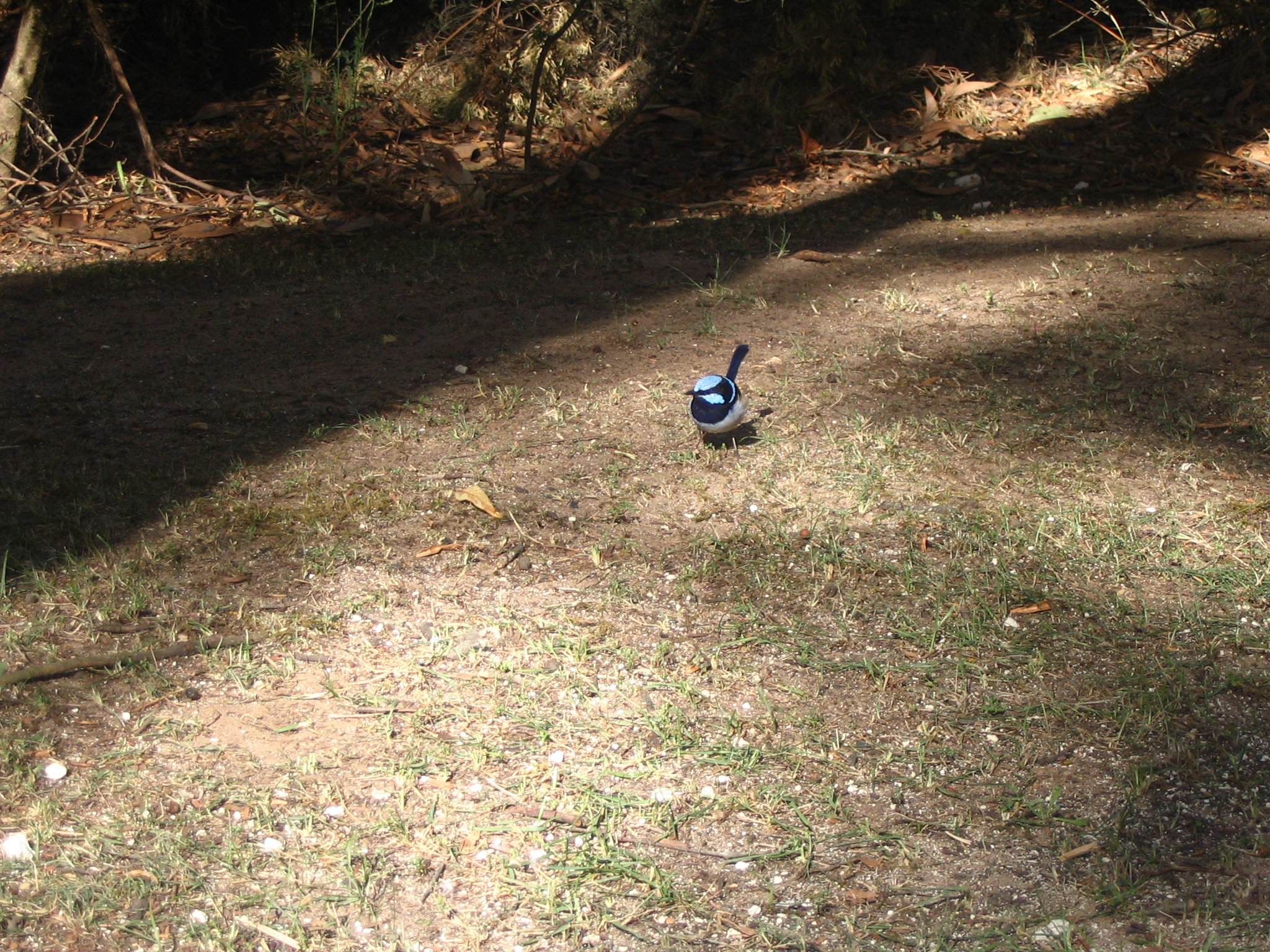
Remembered just about everything except some batteries, charger and soap. Standard boring-as-hell drive to Canberra. Bought a new pair of Docs at Redpath Shoes (URL on bag is defunct), seemingly the last purveyor of Docs in south-eastern Australia. Dinner from Sammy's, ate it on the lake near the National Museum. Lots of little wrens enjoying themselves, including a beautiful blue fairy wren that skillfully avoided my camera. Met up with Dave after work at 10:30pm, talked with him and Luke until 3am.
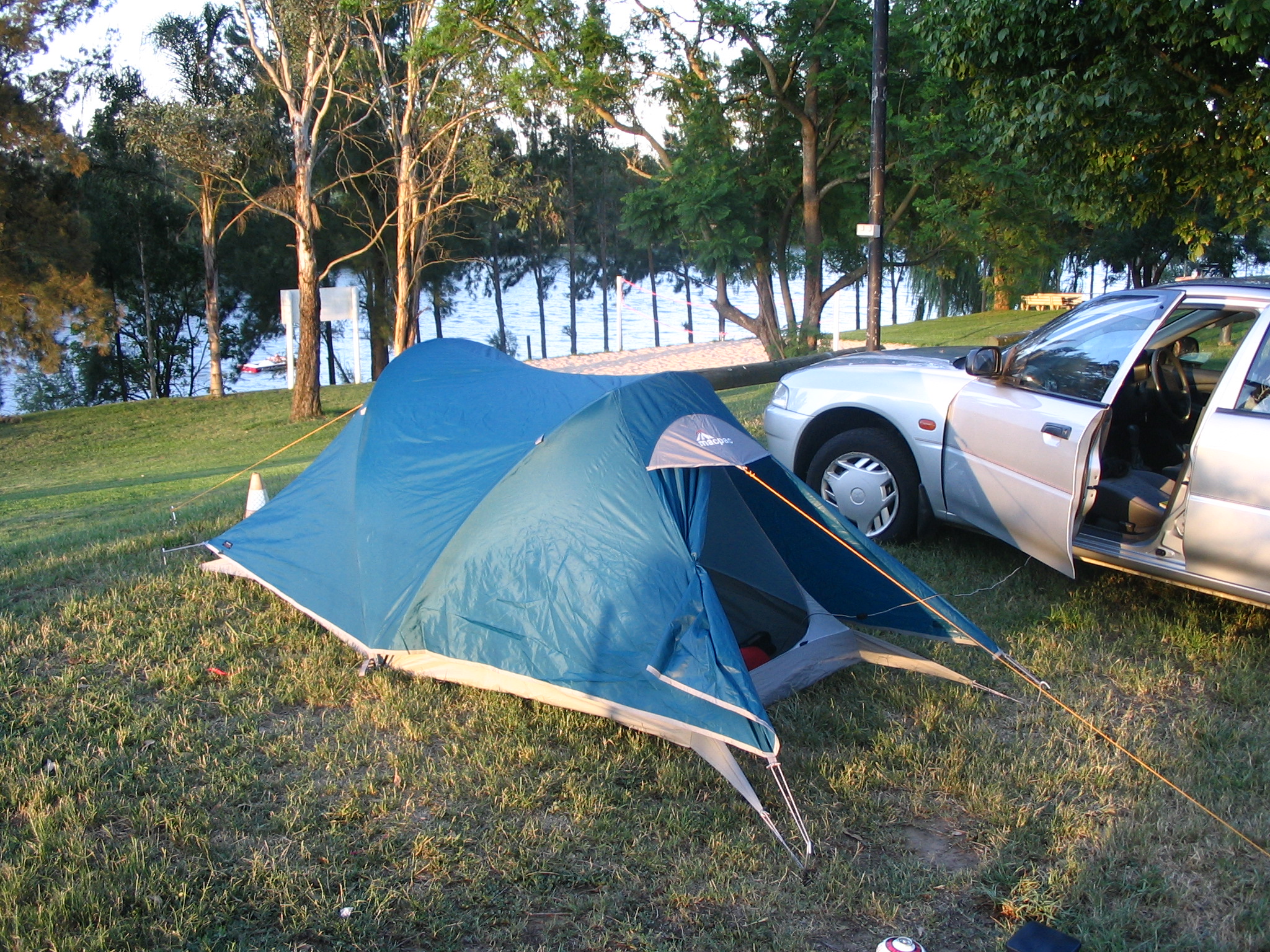
Decided to try out my tent by spending a night out at the Hawkesbury Riverside Tourist Park with the idea that if things got unbearable then it was only a 50km drive back to civilisation.
The park is on the outskirts of tiny Pitt Town, near Windsor. I got there around 5pm, early enough to attempt to swim across the river. My feeble modified-dog-paddle attracted the attention of one of the local motorboat drivers who kindly came over to make sure I was OK. There are loads of motorboats on the Hawkesbury, most with water skiers hanging off the back. It's a bit harder to float without salt in the water.
The lady very kindly let me pitch my tent overlooking the water, which is why there is such a similarity between my photo and their promo. The tent went up easily enough and the cooking gear went well too. All very low key and unexpectedly easy, if somewhat time-consuming. I was a bit surprised to get up the next morning and find the fly dripping wet, inside and out, while the inner tent was perfectly dry. It hadn't rained, but the dew was much heavier than I imagined. I wonder what one does with a wet tent on a several-day hike.